Four LNER-related stations, the questions, start in the top left corner and go round clockwise:
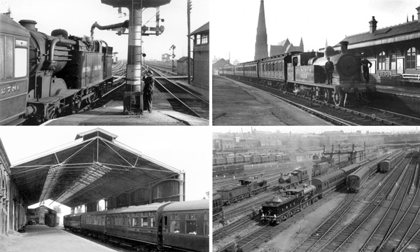
1 - A scene on the GNML in 1950 with an N2 hauling ECS taking water. Identify the station, and the purpose of the more distant signal box.
2 - An LNER view in which the church was demolished in 1960. Name the station and original operator.
3 - The station throat of this terminus contains five LMS locos and an LNER one. Name the station and the two pre-Grouping operators.
4 - When a new station was opened nearby in 1902, the old terminus, seen in the 1960s, remained in use. Name and reason for its extended use, please.
Answers on New Year's Day, 1st January 2020, with commendations as appropriate. Good luck! If you'd like to submit your thoughts please use Contact/feedback via either of the menus or Contact/feedback.
Click on the image for an enlargement
The answers
In clockwise direction from the top left:
1 - The location is Wood Green station, nowadays named Alexandra Palace, looking south. Here's part of the OS 25" map from 1937:
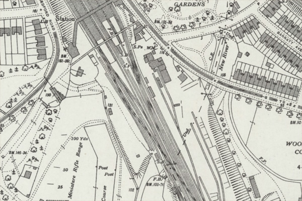
Leaving King's Cross the GNML was flanked by carriage sidings and, at Wood Green, the branch for Enfield came off (to be taken over the Main Line by a flying junction). Just south of the station there were 10 tracks and unsurprisingly, there were four signal boxes which in the 1947 Sectional Appendix were named "Wood Green" and "Wood Green Nos.2 to 4". The map shows the main lines running through the station and the Down line to Enfield on the left/west side. Source: OS 25", National Library of Scotland.
In the quiz photograph, "Wood Green No.4" is to the immediate right and the more distant box - subject of the second part of the question - "Wood Green" - is on the map, a quarter of the way up from the bottom marked "S.B.". Its main purpose was to control the Down passenger and goods lines to Enfield and the loading dock for Alexandra Palace and its racecourse (horses were delivered here until the course closed in 1970).
Click on the image for an enlargement
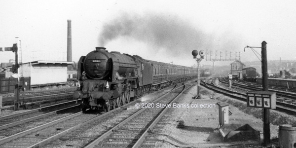
A 1960s view shows Peppercorn A1 No 60148 Aboyeur racing through Wood Green on the Down Fast Line while what looks like a Class 25 approaches on the Down Slow Line about to be turned off for the Enfield Branch. To the right is the aforementioned signal box and the loading dock for Alexandra Palace and its racecourse (remains of which I am told can still be seen today). Photo: Author' collection.
Click on the image for an enlargement
2 - The station shown was Wrexham Central which was operated by the Wrexham, Mold and Connah's Quay Railway.

Here's the station on a 25" OS map from 1909. St. Mary's church can be seen (demolished in 1960). The WM&CQR was acquired by the GCR hence that company's loco and carriages in the quiz picture. Source: OS 25", National Library of Scotland.
The station was rebuilt in modern times and remains in use today.
Click on the image for an enlargement
3 - A vast panorama of Bradford and Forster Square station, built by the MR with running rights by the NER. It's hard to tell if the LNER train approaching the camera was an express leaving tender-first, or the elderly D23 was serving as the LNER's station pilot.
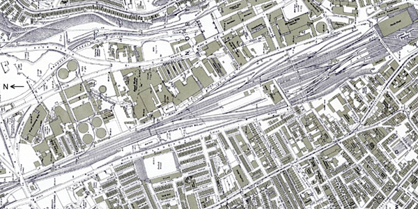
This was a large site so I have turned the map (of 1934) through ninety degrees. Siding capacity here was used to house entire Bradford/Leeds expresses to St.Pancras, reversal being required at Leeds Wellington St. station (later part of Leeds City). Source: OS 25", National Library of Scotland.
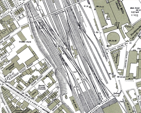
Additional map. The photo was taken from a footbridge which is at the top of this enlargment. The station is still with us today. Source: OS 25", National Library of Scotland.
Click on the image for an enlargement
4 - The sketch map below shows all the stations at Newmarket. The original one was a terminus which because of the lie of the land could not be turned into a through station. An island platform was added on the line to the north (Ely) and east (Bury St. Edmunds) and then an additional station at Warren Hill to help serve racecourse traffic from the north - the course was actually on the other side of town! The nettle was finally grasped when a new station with through platforms was built and opened in 1902.

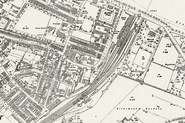
The OS 25" map (of 1926) shows the old station. It was kept in use for three reasons - as the main goods depot, to help handle race excursions, one of which can be seen in the quiz picture complete with an ex-GER restaurant car, and to load and receive racehorses. For which loose piles of hay/fodder can be seen on the platform.
Hence the old station stayed alive until 1967. Instead of a station pilot, shunting horses were used to the end, becoming the last examples on British Rail. The station building had a grand Italianate exterior and was listed but, alas, it fell into disrepair and there was quite a stink when it was pulled down in 1981. Source: OS 25", National Library of Scotland.
Click on the image for an enlargement
And the winners is - John Law - well done! - who got most of them right.


